Iqalugaarjup Nunanga Territorial Park
Visitors can immerse themselves in a Stone-Age Culture by visiting the nearby Iqalugaarjup Nunanga Territorial Park and catch glimpses of Ancient Inuit Traditions. This Thule Site as well as a newly built “Qangmak” or Traditional Sod House, which were seasonal dwellings for Inuit, are located on the mouth of the Meliadine River which is 5 km north of Rankin Inlet and accessible by road. Both the Meliadine River & nearby Diane River are favorite fishing spots for local residents.
Marble Island
One of the most exciting attractions to the Rankin Inlet area is Marble Island, an amazing quartzite island northeast of Rankin Inlet, about 40 km out (an hour’s travel by fast boat) in Hudson Bay. It figures strongly in Inuit legends and has been given a unique designation as an “Area of Exclusive Possession” under the Nunavut Land Claims Agreement. For non-Inuit, access to the island is permitted only with a local guide. You can get out there in June, July, or August. From the ill-fated James Knight expedition of 1719 to the overwintering whalers of the 19th century, the island is a place of intriguing history and haunting stories. The stark graves of whalers line the beach on Deadman’s Island and piles of old iron barrel hoops indicate areas where whale blubber was rendered into oil. At Knight’s Harbour, arctic foxes hide eider eggs amidst the foundations of the old stone house that sheltered the sailors of the Knight Expedition. Belugas, ringed and bearded seals, and polar bears are sometimes seen. Unainuk Tours offers boat tours to Marble Island in August. www.marbleisland.ca
Traditional Camping and Settlement Areas
>If you walk to the Con Shed, and along an ATV trail inland from the building, you will come to an area where people camped before Rankin was a community. The town was traditionally a place to camp and visit when following the caribou migration. It wasn’t until the 1950s and 1960’s that Inuit settled in the area to work for the Nickel Mine. You can still observe stone tent rings, kayak racks, and storage caches in this area, between the tank farm and the sea.
When people began to settle in Rankin Inlet, they did so in the Itivia, near the current barge dock and FOL (Forward Operating Location). None of the original buildings remain today, and the area will become the laydown area for shipments for the Meliadine Gold Project.
Throughout several areas in town, you will see dog teams are staked out. Some are racing sled dogs used in local races; others are used traditionally for hunting and travelling on the land, though no one now depends on dog teams for travel.
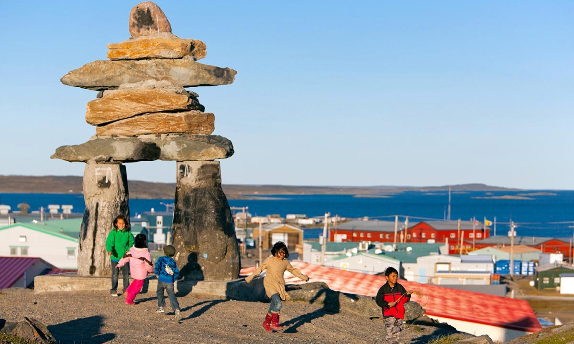
Town Inukshuk
An immense stone inukshuk overlooks the downtown area. Representative of the stone figures that guide people on the land, this 15 foot structure was designed by Joe Nattar and built by a team of Inuit in 1991.
Small Craft Harbour
A small craft harbour in Johnston’s Cove is an interesting place to visit. The tides here are about 13 feet high, and this is very apparent when you walk out on the jetty. Local boats are anchored out in the harbour. People use small dinghies to access these, leaving the small boat tied to the anchor float while they are out in the larger one. You will see long strands of kelp washed up by the tide, and can see some of the older wooden boats up on cradles on the shore. Hunters returning with maktaaq (whale blubber) from a beluga hunt will unload their boats along the wharf.
Pakallak Tyme
For an exciting cultural adventure, visit Rankin Inlet during its’ Annual Hamlet Days or “Pakallak Time”. This Spring Festival is a chance for residents and visitors, to get together for some fun, at the end of the long Arctic winter. It is usually scheduled the end of April and beginning of May each year.